25 km north of Pergamon the Madra Daği mountains rise to 1344 metres.
Two tributaries of the Bakır Çayı river (the ancient River Kaikos) pass on either side of the Pergamon Acropolis: to the west the Bergama Çayı (the ancient Selinus) which flows through Bergama (see also gallery 1, page 8); and to the east the Kestel Çayı (the ancient Ketios) which was dammed in 1992 below the acropolis to form an artificial U-shaped lake (see gallery 1, pages 25 and 26). |
|
|
| |

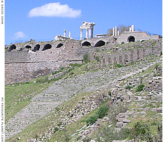
Close-up of the photo above, showing the top of the Theatre, the
reconstructed marble columns and architrave of the Temple of Trajan
and the arched tunnels of the terrace on which it stands. |
Maps, photos and articles: © David John,
except where otherwise specified.
Additional photos: © Konstanze Gundudis
All photos and articles are copyright protected.
Images and materials by other authors
have been attributed where applicable.
Please do not use these photos or articles without permission.
If you are interested in using any of the photos for your website,
project or publication, please get in contact.
Higher resolution versions are available on request. |
| |
 |
Visit the My Favourite Planet Group on Facebook.
Join the group, write a message or comment,
post photos and videos, start a discussion... |
|
|
| |