|
|
 |
| My Favourite Planet > English > Europe > United Kingdom > England > Avebury > gallery |
 |
| Avebury, Wiltshire |
Avebury gallery |
 |
 |
55 of 67 |
 |
 |
|
 |
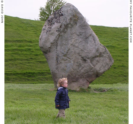
Young visitor inspects the megaliths of Avebury Henge. |
The landscape around Avebury is made up of low rounded hills and plains formed by chalk deposits covered with top soil around 20 cm deep (see gallery page 21). The site of the Henge is slightly domed, and it is thought that when it was in use the top soil and grass were scraped away to reveal the dazzling chalk surface.

A henge has been defined as a ceremonial enclosure surrounded by a bank and ditch with at least one ceremonial entrance. What kind of ceremonies took place here? No one knows, as the ancient British inhabitants seem to have left no written or pictorial clues. From the patterns of unhewn stones, the study of their pottery, tools and other objects as well as comparison with other contemporary cultures, much has been surmised and much more is slowly being discovered.

Such is the nature of modern research, with its sudden breakthrough dicoveries, twists and turns and the plethora of theories, that today's solid "fact" is tomorrow's embarrassing misinterpretation of the available evidence. So all the dates, facts and figures here may look pretty silly in a few years.

Building of the henge began between 2900 and 2600 BC, and continued over 500 years. During this time, the older Neolithic (New Stone Age) culture of the area was replaced by that of the Beaker People, named after the pottery drinking vessels they made, at the beginning of the Bronze Age.

As with West Kennet Avenue and Beckhampton Avenue, the Henge's builders used sarsen stones, huge, hard sandstone blocks, some more than 3 metres high and weighing over 60 tons, which were hauled from Eocene period (26 million years ago) beds on the Marlborough Downs 2-3 Km east of Avebury. It is thought that the stones, which once lay around much of the local countryside were deposited there by glaciers during the Ice Age.

The entire site is 427 metres in diameter and 1.35 km in circumference covering 11.5 hectares. Much has been destroyed and altered by man and nature, and only 27 of the more than 160 megaliths remain standing. However, a survey by the National Trust in 2003 revealed that another 15 stones lie buried on the site, and proposed hi-tech probes may discover more of the henge's secrets. The following is a description of how it is said to have appeared at its completion.

The henge was surrounded by an enormous circular earthworks consisting of a 11 metre deep, 12-15 metre wide ditch and a 6 metre high outer bank. The ditch may have been filled with water, which would have made the site look like an island. Very dramatic.

There were four entrances to the Henge, roughly from the four cardinal points of the compass. The west and south entrances were approached by megalith-lined avenues. The western Beckhampton Avenue, of which little has survived, snaked around south-westwards to Beckhampton 1.5 Km away.
 |

 |
| |
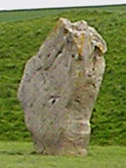
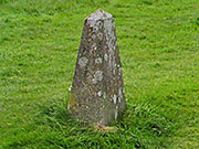
The "Barber Stone"
under which a 14th century skeleton was discovered.

See gallery page 54. |
| |
 |
| |
 |
| |
 |
|
The southern West Kennet Avenue, took a more direct route 2.4 Km south-eastwards to the Sanctuary, a more ancient stone circle (around 3000 BC) on Overton Hill. Much of the West Kennet Avenue is still to be seen (see gallery pages 23 - 43).

The Henge had a great outer ring 335 metres in diameter of 98 sarsen stones (only 27 remain), some over 3 metres high. It is the known largest prehistoric stone circle in Europe, 4 times the size of Stonehenge.

Within the great ring there were two smaller stone circles, each of 30 stones. The northern ring, 98 metres in diameter centred on a three-stone "cove" which was aligned with the midsummer sunrise. The southern ring, 108 metres in diameter, contained a 5.5 metre obelisk and other stones which were destroyed in the mid 18th century. Much of the southern ring now lies beneath village buildings.

During the the second millenium BC, Avebury lost its dominance as a cultural and religious centre, and focus moved to Stonehenge. The Beaker People were supplanted by newcomers such as Celts and eventually other tribal groups moved to Britain. The Romans also left their roads and other marks on the area before sloping off to decline. The old religions were supplanted by new, until Christianity took hold of the the whole island. |
|
| |
Articles and photos: © David John, except where otherwise specified.
Many thanks to Mark Mallett, my host and guide in Wiltshire.
Some of the information and photos in this guide to Avebury
first appeared in 2005 on www.davidjohnberlin.de.
All photos and articles are copyright protected.
Images and materials by other authors have been attributed where applicable.
Please do not use these photos or articles without permission.
If you are interested in using any of the photos for your website,
project or publication, please get in contact.
Higher resolution versions are available on request.
My Favourite Planet makes great efforts to provide comprehensive and accurate information
across this website. However, we can take no responsibility for inaccuracies or changes made
by providers of services mentioned on these pages.
We welcome considerate responses to these articles and all other content on My Favourite Planet.
Please get in contact. |
|
 |
Visit the My Favourite Planet Group on Facebook.
Join the group, write a message or comment,
post photos and videos, start a discussion... |
|
|
| |
|
|
| |
| |
 |
| |
 |
| |
 |
| |
 |
| |
 |
| |
 |
| |
George Alvanos
rooms in
Kavala's historic Panagia District
Anthemiou 35,
Kavala, Greece
kavalarooms.gr
|
| |
Olive Garden Restaurant
Kastellorizo,
Greece
+30 22460 49 109
kastellorizo.de
|
| |
Papoutsis
Travel Agency
Kastellorizo,
Greece
+30 22460 49 286
greeklodgings.gr
|
| |
|