|
|
|
| My Favourite Planet > English > Europe > Greece > Thrace > Alexandroupoli |
| Alexandroupoli, Greece |
Introduction to Alexandroupoli |
|
 |
page 1 |
 |
|
| |

The seafront of Alexandroupoli, Thrace, with the Rhodope Mountains rising to the north. |
| |
|
| |
Alexandroupoli - transport hub
of the Northeastern Aegean |
| |
Alexandroupoli is a small, modern city, pleasant though not remarkable, with few tourist attractions. As you can see from the map below, it is the easternmost city and port on the Greek mainland and the most important transport hub in Thrace. Most visitors are just passing through on their way to and from local destinations, the island of Samothraki and the Turkish and Bulgarian borders.
If you are staying longer in the city or a nearby village, or have a few hours while waiting for a plane, bus, train or ferry, there are plenty of shops, restaurants and cafes around the port and in the centre, as well as a few churches and small museums you may like to visit. There are also beaches within easy reach (see page 5: sightseeing). |
|
 |
| |

The symbol of
East Macedonia
and Thrace |
| |
| |
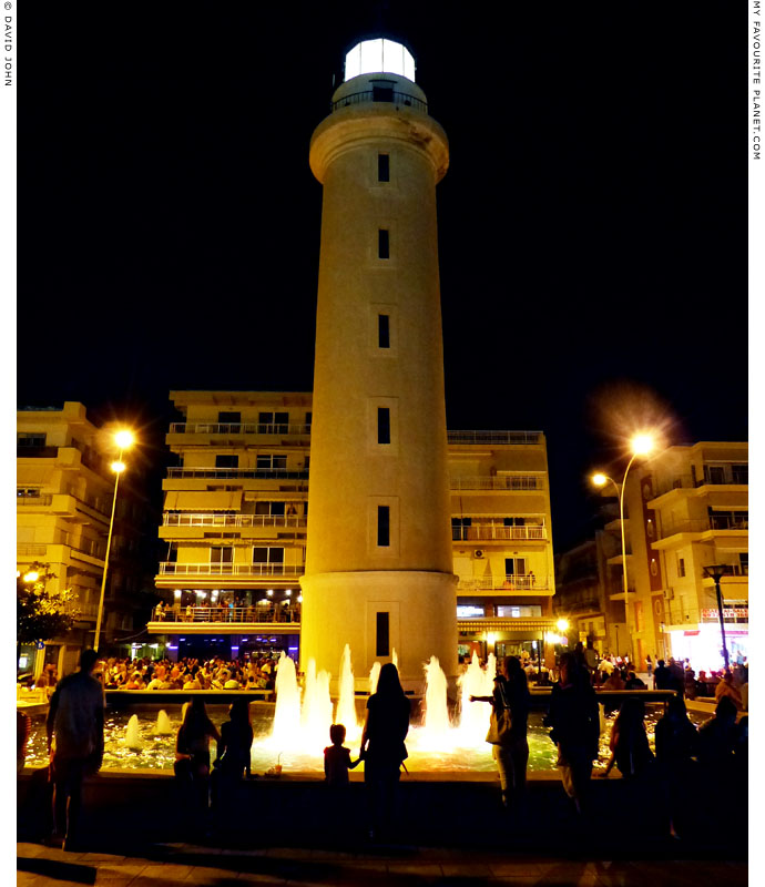
The "Faros" Lighthouse on Alexandroupoli's seafront promenade,
where locals take their evening volta and meet in restaurants and bars.
A pool with an illuminated fountain adorns the foot of the venerable beacon. |
| |
| Alexandroupoli |
Facts and figures |
|
 |
|
| name: |
Alexandroupoli (Greek, Αλεξανδρούπολη, City of Alexander),
also known as Alexandroupolis
Named after King Alexander I of Greece, who visited the city in 1920.
Previously, as part of the Ottoman Turkish Empire, it was known
as Dedeagach (Greek, Δεδεαγάτς; Turkish, Dedeağaç; Bulgarian, Дедеагач).
Alexandroupoli is the site of ancient Greek city of Sale (Σάλη; also referred
to as Sala), a colony of Samothraki. See History of Alexandroupoli.
|
|
| country: |
Greece
|
| location: |
Alexandroupoli is the easternmost port city in mainland Greece.
It stands on the coast of the Thracian Sea (part of the North Aegean Sea), northeastern Greece; around 14 km west of the mouth of the Evros River
(see page 5: Sightseeing) and the border with Turkey, although
the nearest border crossing is over 30 km away.
Distances:
840 km northeast of Athens
352 km east of Thessaloniki
149 km east of Kavala
121 km southeast of Xanthi
68 km southeast of Komotini
108 km south of Orestiada
43 km northeast of Samothraki island
300 km west of Istanbul, Turkey
All distances are approximate and can differ, depending on routes.
|
| periphery: |
(administrative region) East Macedonia and Thrace (capital Kavala), which is
part of the larger semi-autonomous Macedonia Region (capital Thessaloniki).
For further information about the administrative divisions, towns and cities
of Macedonia, see our Macedonia facts and figures page.
For further information about Greece's administrative regions,
see our introduction to Greece, Greece page 4: Facts and figures.
|
| regional unit: |
Evros (Έβρος), capital Alexandroupoli
|
| municipality: |
Alexandroupoli
|
| area: |
Municipality: 1,219.9 square kilometres
|
| population: |
Municipality: 72,959
Municipal unit: 61,702
Community: 58,125
(2011 census)
|
| local time: |
Eastern European Time (EET)
Daylight Saving Schedule:
Summer (from last Sunday in March) GMT/UTC +3 hours
Winter (from last Sunday in October) GMT/UTC +2 hours
|
| currency: |
Euro (€)
|
| climate: |
Mediterranean (temperate, with wet winters and hot, dry summers)
|
| language: |
Greek
|
| post code: |
681 00
|
| telephone code: |
+30 25510
|
| website: |
Alexandroupoli Municipality: www.alexpolis.gr
In Greek and English, although at present
there is not much information in English. |
|
| Further information for Greece can be found in our introduction to Greece pages. |
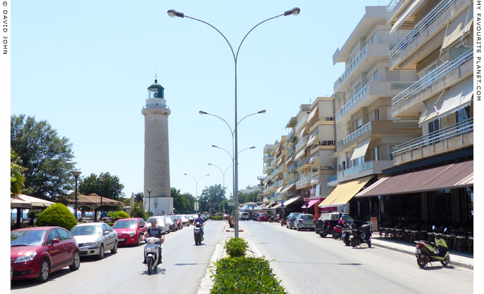
Odos Vasileos Alexandrou (King Alexander Street), Alexandroupoli's seafront promenade,
on which stands its landmark lighthouse and a number of grand public buildings
(see Sightseeing in Alexandroupoli). |
| |
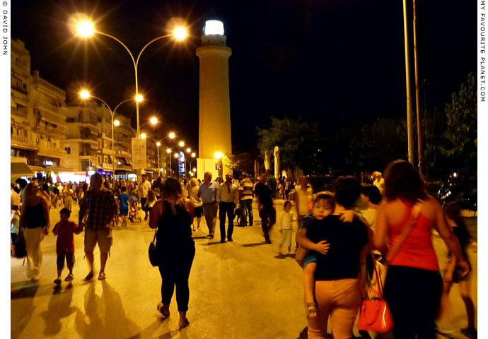
"Pame volta" - let's go for a walk. In Alexandroupoli, as in towns and villages all over Greece, people
take their evening constitutional stroll before dinner. Usually the main street or seaside promenade
is the place to enjoy a sunset and the cool evening air, to see and be seen, to meet and greet. |
| |
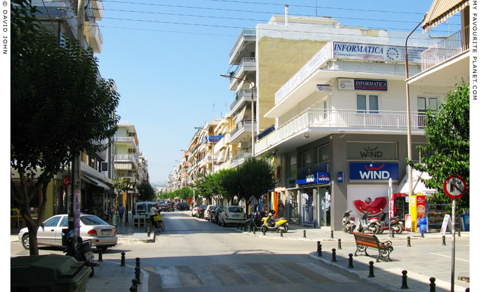
Odos Eleftheriou Venizelou - just another modern street in the centre of Alexandroupoli. |
| |
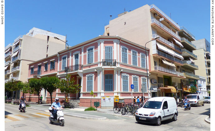
The variety of architecture in Alexandroupoli reflects its short but eventful history. |
| |
| Alexandroupoli |
Area map |
|
 |
|
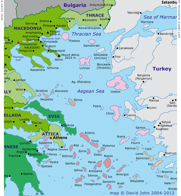
Interactive map of Macedonia, Thrace, Central Greece and the Aegean.
Colour key for Greek island groups (west-east)
| |
|
Argo-Saronic |
|
|
|
Sporades |
|
|
|
Cyclades |
|
|
|
Northern Aegean |
|
|
|
Dodecanese |
See also our interactive map of Greece. |
Photos, maps and articles: © David John,
except where otherwise specified.
All photos and articles are copyright protected.
Images and materials by other authors
have been attributed where applicable.
Please do not use these photos or articles without permission.
If you are interested in using any of the photos for your website,
project or publication, please get in contact.
Higher resolution versions are available on request.
My Favourite Planet makes great efforts to provide
comprehensive and accurate information across this website.
However, we can take no responsibility for inaccuracies or changes
made by providers of services mentioned on these pages. |
| |
 |
Visit the My Favourite Planet Group on Facebook.
Join the group, write a message or comment,
post photos and videos, start a discussion... |
|
|
| |
|
|
| |
| |
 |
| |
 |
| |
George Alvanos
rooms in
Kavala's historic Panagia District
Anthemiou 35,
Kavala, Greece
kavalarooms.gr
|
| |
 |
| |
 |
| |
 |
| |
 |
| |
Olive Garden Restaurant
Kastellorizo,
Greece
+30 22460 49 109
kastellorizo.de
|
| |
Papoutsis
Travel Agency
Kastellorizo,
Greece
+30 22460 49 286
greeklodgings.gr
|
| |
|