|
|
|
| My Favourite Planet > English > Europe > Greece > Northern Aegean > Samos |
| Samos, Greece |
Introduction to Samos |
|
 |
page 1 |
 |
|
| |

Panoramic view over the harbour of Pythagorio, on the south coast of Samos. |
| |
|
| |
| Samos – a green and buxom island |
| |
Samos has an impressive landscape of verdant, rounded hills above which soar two ranges of rocky mountains, in the centre and at the west of the island (see, for example, photos on gallery page 34). Farmlands on a number of plains around the coast produce a variety of crops, most notably the famous sweet Samian "Muscat" wine.
As the eighth largest Greek island it has a couple of small towns and numerous villages around the coast and among the hills. The main roads connecting the settlements are mostly narrow but generaly well built. There are also many smaller minor roads and dirt tracks in remoter areas. For hikers and cyclists there are several footpaths, although they are not marked on most maps.
Many traditional houses and buildings can be seen, especially in the villages, and the church architecture is quite remarkable, with plain stone topped by outlandlish blue and white striped domes.
As well as the usual evenings of traditional bazouki music in local tavernas, you may also be lucky enough to enjoy summer concerts by some of Greece's best musicians and theatre performances at the ancient ampitheatre in Pythagoria.
Add to this scene wide, sandy beaches stretching along the coast of the deep blue Aegean, and you have a very attractive and charming setting. This has not escaped the notice of the Greek and foreign visitors who choose to spend their holidays here. Although popular with tourists, there is little sign of the mass tourism found on Rhodes, Crete or the Cyclades.
In antiquity Samos was a powerful independent city state and the bithplace of several notable people, including the philosopher and mathematician Pythagoras. Not much has survived from these heydays except a couple of quite bare archaeological sites, including the famous Sanctuary of Hera, and two small museums. Unfortunately, most of the more historically and artistically important archaeological objects found on Samos are now in other museums around the world. |
As in many places in southern Europe, summer wildfires are a great danger to the ecology of the island and the livelihood of its inhabitants. Following a particularly disatrous fire on Samos in 2000, which devastated forests and farmlands, more resources have been invested in prevention and fire-fighting by land and from the air.
The coast of Turkey is only 1.6 km from the east of the island, and Samsun Daği, known in ancient times as Mount Mykale (Greek, Μυκάλη), can be clearly seen from the southeast coast. In summer daily ferries cross between Samos and the Turkish seaside resort of Kuşadası (see page 3: How to get to Samos), from where many visitors travel to the nearby sites of the ancient Ionian cities Ephesus, Priene, Didyma and Miletus. |
|
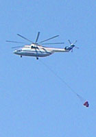
Fire-fighting helicopter
over Kokkari, Samos. |
| |
| Samos |
Facts and figures |
|
 |
| name: |
Samos (Greek, Σάμος)
|
| country: |
Greece
|
| location: |
Samos is in the eastern Aegean Sea, 67 km southwest of Chios and 35 km north of Patmos.
At its closest point it is separated by only 1.6 km west from the Anatolian coast of Turkey by the Samos Strait (Στενό Σάμου, Steno Samou), also known as Mykale Strait (το Στενό της Μυκάλης), and the Eptastadio Channel (Επτασταδιο Πορθμό); in Turkish as Sisam Boğazı (Samos Strait).
See gallery page 29.
Samos is the 8th largest Greek island.
|
| periphery: |
(administrative region) North Aegean Region
(Greek, Περιφέρεια Βορείου Αιγαίου)
Capital: Mytilene (Lesbos)
For further information about Greece's administrative regions, see our introduction to Greece, Greece page 4: Facts and figures.
|
| regional unit: |
Samos
|
| municipality: |
Samos
|
| capital: |
Vathy (or Vathi), also known as Samos Town
(Greek, Βαθύ, which means "deep"; also known as Κάτω Βαθύ, Kato Vathy, Lower Vathy; and Λιμήν Βαθέος, Limin Vatheos, Vathi Port)
Vathy, on the northeast of the island, is the largest town and main port. Population 12,384.
|
| communities: |
Other towns and villages:
Pythagorio (or Pythagoreio, Πυθαγόρειο), the ancient capital of the island. Known until 1955 as Tigani (Τηγάνι).
Chora (Χώρα), island capital during Ottoman Turkish times, until 1854.
Karlovasi (Καρλόβασι), port and second largest town.
Kokkari (Κοκκάρι), seaside village on the north coast.
|
| area: |
476 square kilometres
Samos is 44 km long west-east, and 19 km north-south at its widest point; at its narrowest point, at the east of the island, it is only 5 km wide.
|
| highest point: |
Vigla (Βίγλα), the highest peak of Mount Kerkis (Κέρκης), in the west of Samos, 1,434 metres above sea level.
|
| population: |
32,977 (2011 census)
|
| local time: |
Eastern European Time (EET)
Daylight Saving Schedule:
Summer (from last Sunday in March)
GMT/UTC +3 hours
Winter (from last Sunday in October)
GMT/UTC +2 hours
|
| currency: |
Euro (€)
|
| climate: |
Mediterranean (temperate, with wet winters and hot, dry summers)
|
| language: |
Greek
|
| post code: |
931 xx
|
| telephone code: |
+30 2273 |
Further information for Greece can be found
in our introduction to Greece pages. |
|
| |
| |
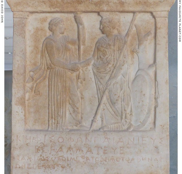
Detail of a marble stele inscribed with Athenian decrees of 405/404 and 403/402 BC
honouring Samos for its loyalty at the end of the Peloponnesian War. In the relief at the
top of the stele Hera, the patron goddess of Samos (left), shakes hands with Athena.
Acropolis Museum, Athens. Inv. No. Acr. 1333. Inscription IG I(3) 127.
Pentelic marble. Height of stele fragment 116.3 cm., width 56 cm. |
| |
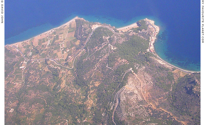
An aerial photo of part of the north coast of Samos. Part of Mount Ambelos, in the centre
of the island, descends to the Aegean Sea, forming a headland around which are a number
of small seaside villages, including Agios Konstantinos and Kambos.
Also visible is the coast road between Kokkari (to the east) and Karlovasi (to the west),
which turns inland to skirt the low plain south of Kambos. In the hills further south are the
ancient marble quarries around the village of Manolates. |
| |
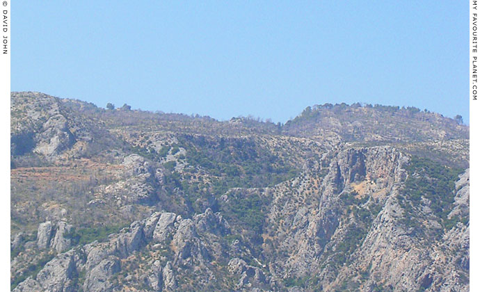
The rugged limestone hills and mountains of Samos are a continuation of the range on the nearby
Anatolian mainland, which include Samsun Daği, known in ancient times as Mount Mykale (Μυκάλη).
See photos and further details on gallery page 29. |
| |
| Samos |
Area map |
|
 |
|
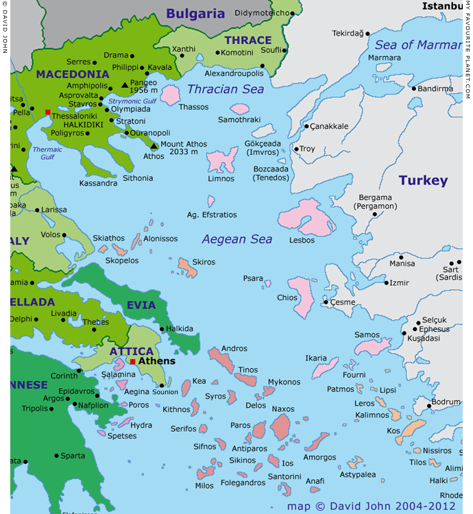
Interactive map of the North Aegean islands
Colour key for Greek island groups (west-east)
| |
|
Argo-Saronic |
|
|
|
Sporades |
|
|
|
Cyclades |
|
|
|
Northern Aegean |
|
|
|
Dodecanese |
See also our interactive map of Greece. |
Photos, maps and articles: © David John 2003-2019,
except where otherwise specified.
All photos and articles are copyright protected.
Images and materials by other authors
have been attributed where applicable.
Please do not use these photos or articles without permission.
If you are interested in using any of the photos for your website,
publication or project, please get in contact.
Higher resolution versions are available on request.
Some of the information and photos in this guide to Samos
originally appeared in 2003-2004 on davidjohnberlin.de.
My Favourite Planet makes great efforts to provide
comprehensive and accurate information across this website.
However, we can take no responsibility for inaccuracies or changes
made by providers of services mentioned on these pages. |
| |
 |
Visit the My Favourite Planet Group on Facebook.
Join the group, write a message or comment,
post photos and videos, start a discussion... |
|
|
| |
|
|
| |
| |
 |
| |
 |
| |
 |
| |
 |
| |
 |
| |
 |
| |
George Alvanos
rooms in
Kavala's historic Panagia District
Anthemiou 35,
Kavala, Greece
kavalarooms.gr
|
| |
Olive Garden Restaurant
Kastellorizo,
Greece
+30 22460 49 109
kastellorizo.de
|
| |
Papoutsis
Travel Agency
Kastellorizo,
Greece
+30 22460 49 286
greeklodgings.gr
|
| |
|