|
|
|
| My Favourite Planet > English > Middle East > Turkey > Ephesus > photo gallery |
| Ephesus, Turkey |
Ephesus photo gallery 1 |
 |
 |
2 of 62 |
 |
 |
|
| |
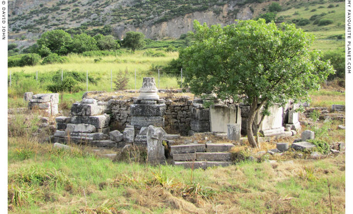
"Saint Luke's Grave", a Roman fountain in the Upper City of Ephesus, outside the archaeological site. |
| |
The Upper City of Ephesus
The Ephesus Archaeological Site has two entrances. This gallery takes the tour from the upper entrance to the lower entrance (see next page).
The area known as the Upper City of Ephesus was a large residential district on the southeast side of the city. The district included the Upper Agora (the "State Agora"), but much of it now lies on either side of the road outside the upper entrance of the Ephesus Archaeological Site.
Not much can be seen of the ruins of the houses and other buildings of this part of the district, which currently lie under grass, bushes and trees and behind high fences. However, from the road it is possible to see the remains the Roman fountain known as "Saint Luke's Grave", the East Gymnasium and the Magnesian Gate.
The 50 hectare district was developed during the Hellenistic period, laid out on a grid system with 24 streets running north-south and 7 running east-west. Within the street system, which remained largely unchanged into late antiquity, were 88 blocks of buildings (insulae), of which the Upper Agora occupied four. The district was provided with water conduits and drainage systems. |
| |
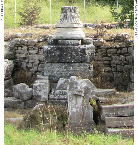
A composite column capital (a mixtureof the Corinthian and Ionic orders)
has been placed upside down on a column base on "Saint Luke's Grave",
the only distinguishing feature now visible on the Roman period fountain.
The fountain stands on the opposite side of the road and to the left (north) of the upper entrance, just after the end of the row of restaurants and shops. Like all the ruins of the Upper City, on either side of the road, the fountain is fenced off.
Built in the 2nd century AD (Roman Imperial period), the fountain was a monopteros, a columnar building without a cella. Around the top of the circular podium 16 composite columns supported an entablature. The basin of the fountain itself stood in the centre of the podium.
Around 500 AD it was converted into a church with a crypt. Several graves as well as pottery and coins discovered around the building indicate that the church was in use until the 13th - 14th century. In the 19th century the discovery of a relief of a cross and a hump-backed ox, the symbol of Saint Luke, on a pilaster at the southern entrance to the crypt led to the mistaken identification of the structure as the tomb of the apostle. The pilaster is still in situ but is on the side of the fountain not visible from the road. |
|
|
| |
| |
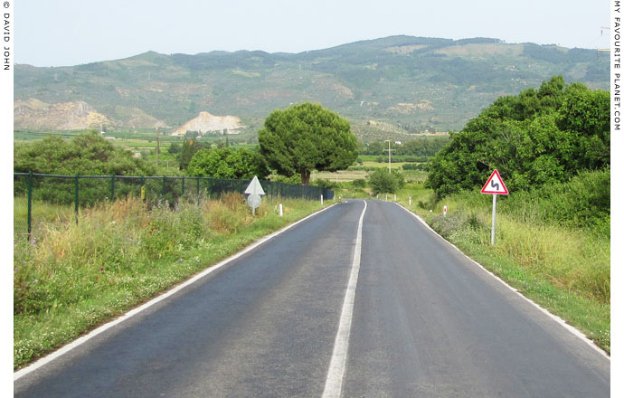
The view downhill (northwards) from the Upper City to Selçuk on the back road up to the
House of the Virgin Mary (9 km), passing the turnoff for the Cave of the Seven Sleepers
(1.5 km from the turnoff, right, 2 km from Selçuk) and the upper entrance of the
Ephesus Archaeological Site (3 km).
The road between Selçuk and the Cave of the Seven Sleepers is quite flat,
but then rises to the upper entrance. From there the slope becomes steeper
as it twists and turns up to the the House of the Virgin Mary (Meryemana). |
| |
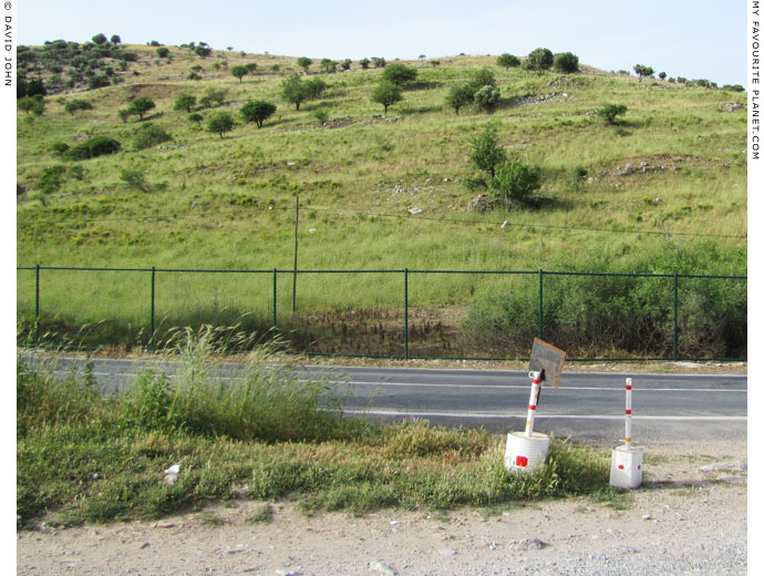
The east slope of Mount Pion (όρος Πίων; Turkish, Panayırdağ), across the road from
"Saint Luke's Grave". This slope is far less steep than on the south and west sides
facing the centre of Ephesus. The remnants of buildings of the 12 blocks of the
Upper city which stood here can be seen scattered around the side of the hill. |
| |
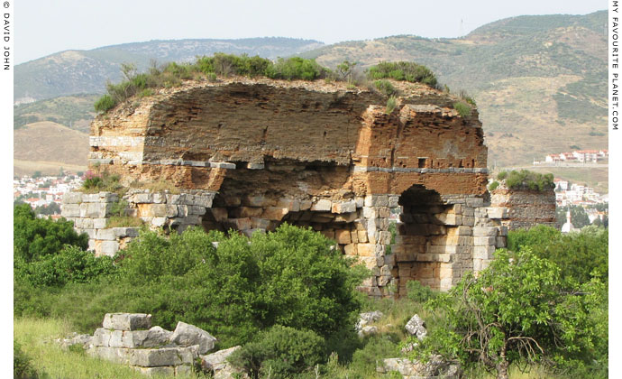
The ruins of the East Gymnasium, downhill (north) from "Saint Luke's Grave",
and further away from the upper entrance.
|
The East Gymnasium and baths complex was built of stone and brick in the 2nd century AD, along the inside of the Hellenistic Walls of the city, on the north side of the Magnesian Gate, and had an area of 14,000 square metres.
Apart from its large bathing halls, the gymnasium also had a richly decorated marble hall and a lecture theatre with tiered rows of seating. The complex also included a school for boys aged six to sixteen. A three-aisled basilica built near the road in late antiquity was used as a cemetery church (see photo below). Statues of Asklepios, Hygeia, Dionysus, Pan and Aphrodite were found here. These statues are now in the Izmir Archaeological Museum.
The discovery of fragments of a dedicatory inscription from an architrave frieze from the palaestra of the gymnasium (IvE 439) led archaeologists to believe that it may have been built or restored in the 2nd century AD by Titus Flavius Damianus (Damianus of Ephesus) and his wife Vedia Phaedrina or daughter (perhaps Antonina), although this remains a matter of debate. In turn, it has been suggested that a statue of a bearded man wearing a bust crown may be a portrait of Damianus (see photo, right) and that a statue of a seated woman may depict Vedia Phaedrina. [1]
The gymnasium is not open to the public, but can be viewed from a distance, through the fence along the left (north) side of the road. A telephone cable has been thoughtfully stretched between two poles in front of the building to improve the view.
Ephesus had several gymnasia and bath complexes, built according to a general plan known as the Ephesian bath-gymnasium type: the East Gymnasium, the Upper Gymnasium, the Scholastikia Baths (or Varius Baths), the Harbour Gymnasium and Baths (or the Gymnasium and Baths of the Emperors), the Theatre Gymnasium and the Vedius Gymnasium. In addition, some of the larger private dwellings, such as the later Bishop's Palace and Byzantine Palace, had their own bathing facilities. |
|
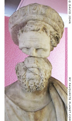
Detail of a marble statue (often
referred to as a statue of an
agonothetes) thought to be a
portrait of the Ephesian Sophist
Titus Flavius Damianus as a
priest of the Roman imperial cult,
wearing a bust crown with 15
miniature imperial and/or divine
busts (all now headless).
Circa 193-211 AD. Found in the
exedra of the East Gymnasium,
Ephesus, 1930. Height 232 cm,
height of head 35 cm.
Izmir Archaeological Museum.
Inv. No. 648.
Another statue thought to be a
portrait of Damianus was found
in the Vedius Gymnasium. |
|
| |
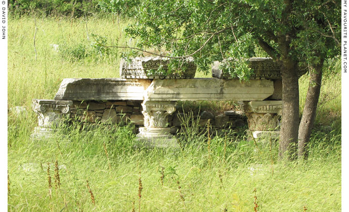
Corinthian column capitals and part of an entablature, perhaps
from the cemetery church, displayed in front of the East Gymnasium. |
| |
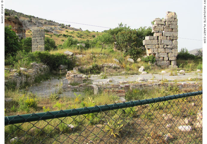
The remains of the Magnesian Gate, to the right (east) of the East Gymnasium.
|
Not much of the gate is visible from the roadside. Here again, the high chain-link fence and the telephone cable enhance the view.
Originally built as part of the Hellenistic fortifications, the Magnesian Gate was reconstructed several times during the Roman period. The main gateway was 3.7 metres wide, with a square gate courtyard measuring 22.8 x 25 metres, flanked by towers. Other remains of the fortifications can be seen from the other side of the road.
The road through the gate was part of the Sacred Way (see gallery page 12) known as the Kathodos (literally, the way down), which led north to a junction on the northeast of Mount Pion to the part of the way known as the Anodos (the way up). From the left of the junction the Anodos led southwest to the Koressos Gate at the north of the city, and to the right it led east down into the Kaystros valley and to the Temple of Artemis. The road then continued north, towards Smyrna (Izmir). In the other direction the road ran inland, southeast to Magnesia ad Maeander and Halikarnassos (Bodrum). Part of the ancient road through the gate has survived to the left (north) of the modern road.
From within the gate a road ran westwards through the Upper City, along the south side of the Upper Agora and ended in front of the Temple of Domitian (see gallery page 5).
At the end of 2nd century AD the wealthy sophist Titus Flavius Damianus (Damianus of Ephesus) financed the building of a marble portico between the Magnesian Gate and the Temple of Artemis. The portico is thought to have been completed around 210 AD. |
|
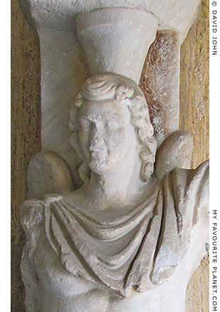
Detail of a marble hermeros (or hip-herm),
a high relief of Eros in the form of a herm,
from a nymphaeum at the Magnesian Gate,
Ephesus, Found in 1926 by J. Keil, built into
a wall. [2] The site of the fountain can no
longer be seen as it was built over in 1955
during the construction of the road up to
the House of the Virgin Mary.
Roman period, 2nd century AD.
Height 236 cm.
Displayed at the entrance to the Ephesus
Archaeological Museum, Selçuk. Inv. No. 368. |
|
| |
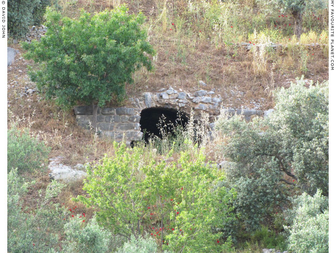
A cave or vault on the east slope of Mount Pion, below the Upper City.
Many such mysterious cave entrances and ruins, not mentioned by guidebooks
or maps, can be seen around the hills around Ephesus. See for example,
a cave entrance high on Mount Koressos, on gallery page 1. |
| |
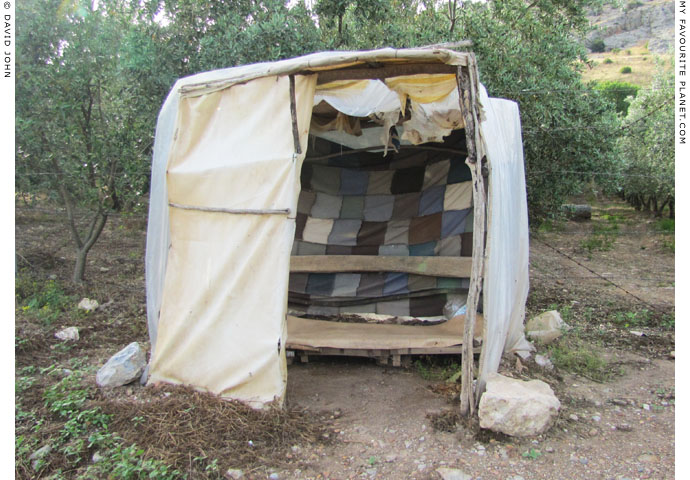
Gimme shelter.
A makeshift shelter in an olive grove, below the Upper City.
A rustic bus stop or Pan's favourite siesta spot? |
| |
Ephesus
Upper City |
Notes, references and links |
 |
|
1. Vedia Phaedrina
Vedia Phaedrina was one of the last of the wealthy Vedii Antonini family (see gallery page 61).
2. Hermeros from Ephesus
See: J. Keil, XII. Vorläufiger Bericht über die Ausgrabungen in Ephesos. In: Jahreshefte des Österreichischen Archäologischen Institut (Öjh) Band 23 (1926), pages 276-278 and fig. 60. Vienna, Austria. |
|
|
Photos, articles and map: © David John,
except where otherwise specified.
Additional photos: © Konstanze Gundudis
All photos and articles are copyright protected.
Images and materials by other authors
have been attributed where applicable.
Please do not use these photos or articles without permission.
If you are interested in using any of the photos for your website,
project or publication, please get in contact.
Higher resolution versions are available on request.
Some of the information and photos in this guide to Ephesus
originally appeared in 2004 on davidjohnberlin.de. |
|
| |
 |
Visit the My Favourite Planet Group on Facebook.
Join the group, write a message or comment,
post photos and videos, start a discussion... |
|
|
| |
|
|
|